
Agriculture Mapping
Affordable drone mapping for farms, estates and rural landowners — understand your fields and assets clearly, without guesswork.
Good decisions on the ground start with clear data from above. Over & Above helps farmers, estate managers and landowners see exactly what’s happening across their land — from basic field overviews to seasonal crop checks and asset mapping.
No big survey crews, no complex software. Just practical, visual data you can actually use.
WHAT WE DELIVER.
Our drone agriculture services include:
Field Overview Maps: High-resolution stitched images to check field boundaries, fence lines, and access tracks.
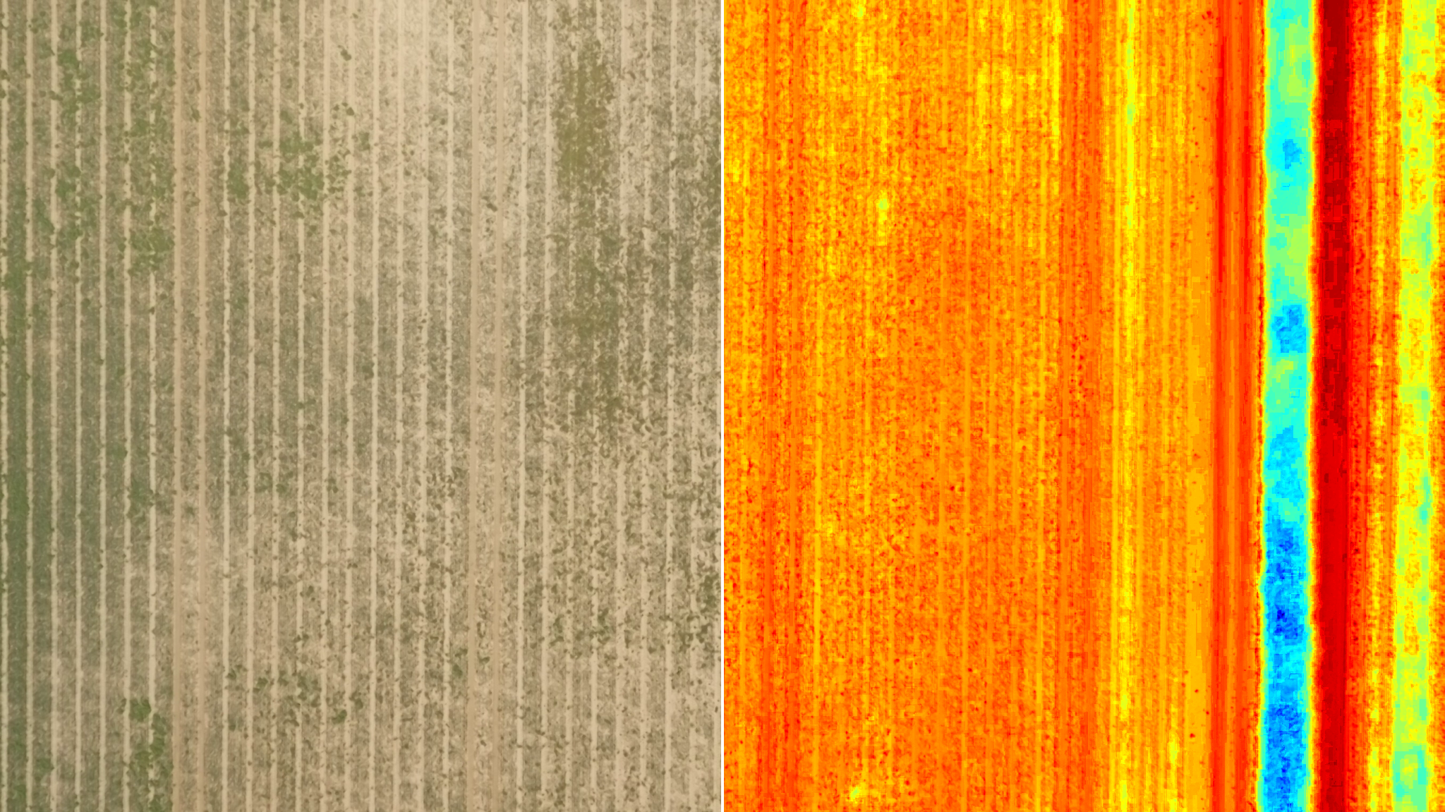
Seasonal Growth Snapshots: Repeat flights during the growing season to highlight patchy growth, waterlogging or crop stress — all visible at a glance.
Basic Asset Surveys: Identify outbuildings, track machinery yards or tree lines for planning, maintenance or insurance.
Solar farm inspections.
You get easy to share GeoTIFF or KMZ files plus simple PDFs with key snapshots - all delivered within 48 hours.

USE CASES
-
Understand and monitor the full layout of your land - fields, tracks, outbuildings and woodland - with geo-referenced aerial images. Ideal for long-term planning, repair prioritisation or ownership records..
-
Monitor crop health from above without walking the rows. Spot irrigation issues, growth inconsistencies or wind damage across large areas - especially useful for vineyards, orchards or polytunnels.
-
Prepare visuals for sales, leases or disputes with accurate mapping. Aerials help settle boundary queries, showcase assets or support negotiations without requiring a traditional survey.
-
Capture visual records of land use, damage or seasonal activity for subsidy claims, environmental scheme checks, or insurance renewals - all documented clearly and safely.
Plan
We agree your fields or areas to cover, plus frequency if you want a seasonal pack.
Fly
CAA-licensed pilot flies an automated grid safely over your land - no disruption to livestock or workers.
Deliver
Final visuals, maps and simple reports in 2 days — files are ready to use or share with your agronomist.
PRICING
ONE-OFF FIELD OVERVIEW
£350
Starting from £350 + VAT - up to 20ha.
A clear, high-resolution orthomosaic of a single field or plot.
Includes:
One flight
Full-resolution orthomosaic image (GeoTIFF + JPG)
Google Earth KMZ overlay (on request)
Delivery within 48 hours
Ideal for:
Boundary checks
Drainage planning
Pre-planting visuals
Seasonal Crop Monitoring Pack
£1000+/quarter
From £1,000 + VAT per quarter (3–4 flights)
Regular aerial mapping across a growing season to spot trends or problem areas.
Includes:
Up to 4 flights per field per quarter
Orthomosaics from consistent flight paths
Optional NDVI-style health overview (visual, not true multispectral)
PDF image reports showing growth changes and crop stress areas
Delivery within 2–3 days of each flight
Ideal for:
Vineyards, orchards, and other high-value crops
Identifying waterlogging, patchy growth or pest damage
Creating a visual crop history over the year
Estate Asset Mapping
£600+
From £600 + VAT (up to 50 hectares)
A one-time capture of key physical assets across large rural properties.
Includes:
High-altitude orthomosaic stitched from multiple flights
Visual documentation of tracks, hedgerows, water access, fencing, buildings
KMZ overlay and basic annotation layer (on request)
Fully geo-referenced output usable in QGIS or Google Earth
Ideal for:
Planning infrastructure upgrades
Forestry or fencing contractors
Stewardship scheme documentation
Prices are all subject to VAT and our Terms & Conditions.
